
The UK is still dealing with serious flooding after one of the wettest winters in recent years. Nearly 90 flood warnings remain active, mostly across England and three in Scotland. More rain will fall through Wednesday and Thursday, adding pressure to already saturated ground.
However, a major weather shift is on the way. Colder air will move in from the north by Friday. This change could bring sunshine, but it will also increase the risk of snow and ice.
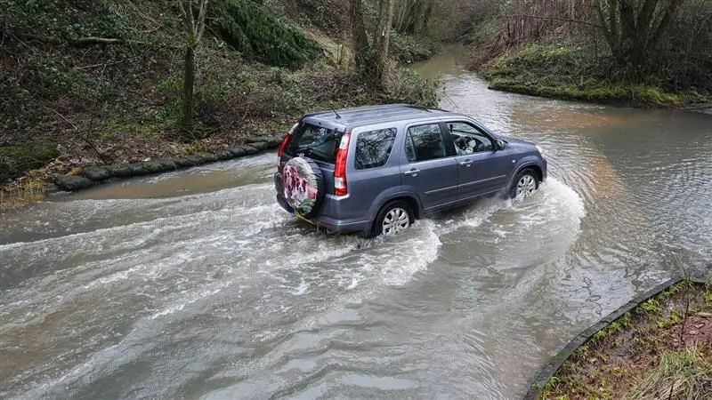
Flood Warnings Remain Across England and Scotland
Dorset and Somerset face the highest flood risk right now. Rivers have overflowed, and groundwater levels remain high. Conditions are unlikely to improve quickly because the soil cannot absorb more water.
In the Midlands, authorities are monitoring the River Trent and River Severn. These rivers respond slowly to heavy rainfall. The good news is that water levels should gradually fall as floodwater moves downstream toward the sea.
Why the UK Has Seen So Much Rain
A strong high pressure system developed over Scandinavia around 17 January. It has stayed in place for weeks. This system blocked normal weather patterns and trapped low pressure systems over the UK.
As a result, slow moving storms brought constant rain. Southern areas experienced south westerly winds, while northern regions saw south easterly winds. This wind pattern shaped where the heaviest rain fell.
That blocking system will finally weaken this week. Once it shifts, colder air will push southward into the UK.
Snow and Ice Warnings Issued
The Met Office has issued yellow warnings for snow and ice across much of Scotland and northern England. The warning runs from Thursday afternoon until Friday midday.
Rain will turn to snow on higher ground first. Some lower areas could also see snowfall for a short time. Locations above 300 metres may receive up to 10 cm of snow.
As skies clear early Friday, temperatures will drop quickly. This rapid cooling will create icy conditions, especially on untreated roads and pavements.
The UK Health Security Agency has also issued yellow cold weather alerts for northern England and the Midlands from Friday morning until Monday.
Wettest January on Record in Some Areas
Several regions have recorded historic rainfall totals this winter. Cornwall and County Down experienced their wettest January on record. Cardinham in Cornwall has reported rainfall every single day this year.
Aboyne in Aberdeenshire has already logged its wettest February on record. This comes just weeks after its wettest January. Aboyne and Aberdeen are also close to recording their wettest winter overall.
Despite the heavy rain, this winter will likely not break the UK record set in 2013 to 2014. That winter saw 691 mm of rain in southwest England and South Wales. So far, December 2025 and January 2026 combined have produced 415 mm.
Storm damage has once again affected the Dawlish railway line in southwest England. A section of sea wall collapsed after repeated storms, causing disruption.
Not Every Region Has Been Soaked
While southern England, Northern Ireland, and eastern Scotland have seen relentless rain, other regions stayed drier. Northwest England and west Scotland had a below average January. Parts of the Highlands recorded just 1 mm of rain this month.
What Happens Next
Next week, the jet stream will return to a more typical position northwest of Scotland. This shift should bring more normal winter weather patterns.
Western Scotland may see more rain again. Eastern Scotland should avoid the extreme rainfall seen recently. Southwest England will likely experience a mix of rain and drier, brighter days.
Toward the end of February, forecasts suggest high pressure could return. If that happens, the UK may finally see calmer and more settled weather.