
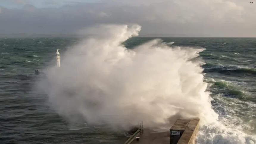
Storm Chandra, which is expected to strike the UK on Tuesday, will bring severe weather. Met Office issued warnings of strong winds, heavy rainfall, and possible flooding following recent storms Goretti, Ingrid, which caused major disruption.
Chandra will bring persistent and heavy rains as well as gales that could be severe in areas exposed to the wind. Waves may overtop sea walls or promenades in coastal regions, and flash floods could occur due to the already saturated soil.
Weather Warnings
It is in force from Tuesday 05:00 – 21:00. The wind could gust up to 120km/h (75mph) and cause damage. Expected rainfall ranges from 30-50mm to 60-80mm higher up, like South Dartmoor.
- Northern Ireland: Rain from 12 noon Monday to 18:00. 10-20 mm across the board, 40 mm on hills
- Valid from 13:30 Monday to 10:00 Tuesday. South-west England (Wales), central southern England (20-30mm), with 80mm or more on Dartmoor and Exmoor.
- London and South-East England: 15-25mm wide, with more in higher terrain like the Chilterns. From midnight on Tuesday to midday Wednesday
- Scotland’s hilly areas: rain turning into snow. 2-5cm on hills around 300m. 10-20cm at 500m. Gusty east winds reduce visibility.
Possible Impacts
Recent storms that have brought rain and winds could lead to:
- Travel delays and cancellations on air, rail or sea
- Flooding roads, businesses, and homes
- Damage to the infrastructure or power outages
- Falling trees, particularly in areas weakened by storms previous
- Flooded roads are cutting off some communities
Chandra’s new rains, combined with the previous downpours of Goretti and Ingrid, increase the risk of flooding.
Storm Naming
Met Eireann in Ireland and KNMI in the Netherlands coordinate with Met Office for storm naming. Chandra is the fourth name after Amy, Bram Goretti and Ingrid. Dave, Eddie and Fionnuala are upcoming names.