
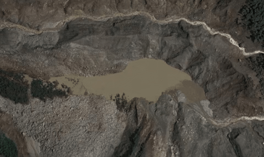
Nepal is closely monitoring two lakes located upstream from an area hit by deadly floods on Wednesday. Officials warn that the flood risk will continue until the lakes drain completely.
One of the lakes began overflowing on Friday. The second lake appears larger and has no visible outlet, raising concerns that water pressure could continue to build.
Quick Facts
| Main Event | Nepal is monitoring two upstream lakes after deadly flooding. |
| Date | August 28, 2026 |
| Location | Nepal |
| Cause | A suspected glacier collapse triggered powerful flood waves. |
| Lake 1 | The lake has started overflowing and draining. |
| Lake 2 | The second lake is larger and has no visible outlet. |
| Main Risk | Further flooding could occur if water is released suddenly. |
| Monitoring | Authorities are using satellite images to track both lakes. |
| Next Step | Nepal plans to install cameras and sensors downstream. |
| Concerned Area | Timure is among the locations being considered for monitoring equipment. |
Nepal Monitors Lakes Amid Flood Risk
Nepalese authorities are monitoring two lakes after powerful floods killed hundreds of people on Wednesday.
The lakes sit upstream from the area affected by the disaster. Officials say flood risks will remain until both lakes fully drain.
One lake began overflowing on Friday. New satellite images showed water leaving the lake basin.
The second lake is creating greater concern. Satellite images show that it has a larger surface area than the first lake.
Officials also found no visible outlet from the second lake in images taken Friday morning. This suggests that water pressure could still be increasing.
Nepal Expands Monitoring After Deadly Floods
Satellite images have become an important tool for monitoring the two lakes.
Authorities believe a glacier collapse caused Wednesday’s disaster. The collapse may have sent rock, ice, mud and other debris into nearby river systems.
The material created powerful flood waves. Those waves destroyed homes and swept away bridges.
A Chinese rescue team captured aerial footage of one lake on Thursday. The footage showed large amounts of brown water collecting in a basin.
By Friday, new satellite images showed water draining from that lake.
Nepal’s Disaster Management Authority says satellite monitoring has limits because fresh images aren’t always available.
Authorities now plan to install cameras and sensors downstream. They are considering locations near the border town of Timure.
Officials are also assessing whether helicopters can help with deployment.
Glacier Collapse Triggers Devastating Nepal Floods
The flooding followed what authorities believe was a glacier collapse in the upstream area.
The collapse pushed large amounts of rock, ice, mud and debris into river systems. This created powerful waves that moved downstream.
The resulting floods caused widespread destruction. Homes were levelled and bridges were swept away.
The two lakes are located close to the area linked to the glacier collapse. Their current water levels are therefore receiving close attention.
The main concern is the possibility of another sudden flood.
If water pressure continues to build in the second lake, a sudden release could send more water downstream.
Communities near rivers could face additional danger if another major flood wave develops.
Officials plan to assess locations for cameras and sensors downstream. Timure is among the areas being considered.
The immediate focus will remain on the second lake because it appears larger and has no visible outlet in the latest imagery.
Authorities will also watch the first lake as its water continues to drain.
Nepal Faces Continued Flood Risk After Disaster
Nepal remains at risk of further flooding after the deadly disaster on Wednesday. Two upstream lakes are now under close observation.
Water has started draining from one lake, but the second remains a concern. Authorities are increasing monitoring efforts to understand the situation and protect communities downstream.