Houston is heading into a wetter weather pattern as tropical moisture moves into Southeast Texas. Rain and thunderstorms are expected to become more common from Wednesday.
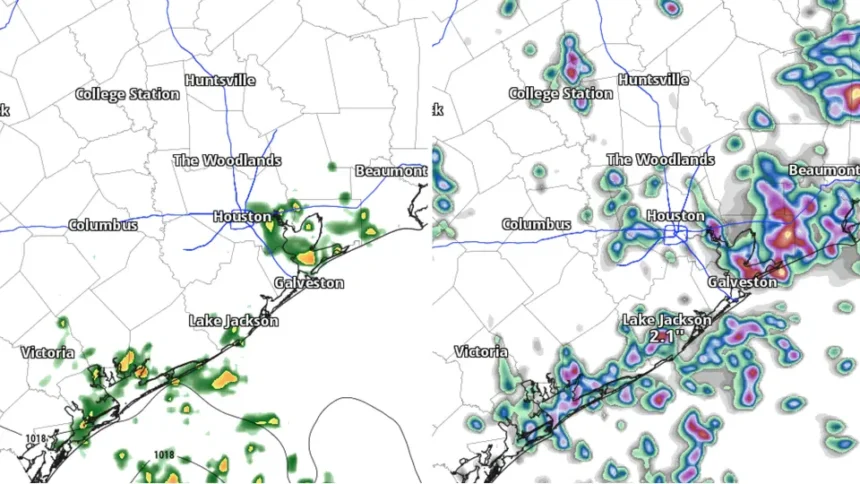
Storm coverage will vary across the region. Houston and areas along and south of Interstate 10 have the best chance of seeing storms. Northern communities may see fewer and more scattered showers.
| Quick Facts: Houston Heavy Rain and Thunderstorms | |
|---|---|
| What happened | Tropical moisture is increasing rain and thunderstorm chances. |
| Where | Houston and parts of Southeast Texas. |
| When | Rain chances rise Wednesday and may continue through the weekend. |
| Main concerns | Heavy rain, lightning, gusty winds and localized flooding. |
| Flood risk | Low overall, but isolated flooding remains possible. |
| Rainfall pattern | Storms may vary by neighborhood, with some areas receiving more rain than others. |
| Why it matters | Slow moving or repeated storms could cause localized flooding. |
Houston Faces Heavy Rain and Storms
After several hot and mostly dry days, Houston will see a shift toward wetter weather.
The forecast remains uneven, though. One neighborhood could receive a heavy downpour while another area stays mostly dry.
Storms may bring frequent lightning, gusty winds and short periods of intense rain. Temperatures will still reach the low to mid 90s.
Heat index values could climb into the triple digits. Overnight temperatures will also stay warm, with lows mainly in the upper 70s and lower 80s.
The main concern is not widespread flooding across Houston. Instead, forecasters expect isolated flooding in areas that receive repeated or very heavy rainfall.
Heavy downpours could temporarily overwhelm streets and low lying areas. Poor drainage could make those problems worse.
Slow moving storms may create the greatest risk. Repeated storms over the same neighborhood could also cause water to build up quickly.
Residents should pay close attention to changing weather conditions, especially when storms begin producing intense rainfall.
Southeast Texas Faces Low Flood Risk
The National Weather Service’s Weather Prediction Center has placed much of Southeast Texas under a Level 1 of 4 excessive rainfall risk for Friday and Saturday.
Isolated flooding can still develop. The risk becomes greater when several storms move across the same location.
Rainfall patterns could change as the week continues. Forecasters will have a clearer picture once they see where the heaviest storms develop.
Houston normally receives about 52 inches of rain each year. Rainfall totals can vary widely from month to month.
Recent dry and hot weather has kept conditions relatively quiet. Tropical moisture will now increase the amount of water available to developing storms.
That moisture can produce intense rainfall in a short period. As a result, even areas that receive little rain during the week could experience sudden heavy downpours.
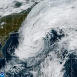
Parts of East Texas also deserve attention. Some locations recently received heavy rain from Edouard, which could affect local flood concerns if additional storms target the same areas.
Heavy Rain May Hit Houston Friday
For most of Houston, the biggest issue will likely be brief periods of heavy rain rather than continuous rainfall.
Drivers should remain alert when storms develop. Water can collect quickly on roads and in low lying areas.
The uneven nature of the storms also makes the forecast difficult. Nearby communities could receive very different amounts of rain.
Friday and Saturday may bring additional storm activity as tropical moisture remains across the region.
Houston Storms Could Bring Local Flooding
Weather conditions should become clearer through Thursday as forecasters track the movement of tropical moisture and developing storms.
The flooding outlook could change if storms become more organized or repeatedly hit the same areas
Houston will see higher rain and thunderstorm chances as tropical moisture moves into Southeast Texas.
Widespread flooding does not appear to be the main concern. Still, intense or repeated storms could cause localized street flooding, especially in areas with poor drainage.