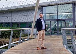
The map took twelve years to create and was projected onto a screen at an industrial estate in Norfolk.
Hundreds of thousands of tiny red dots appear like scattered confetti as Mr. Gooderham, founder of Ordtek, based in Hethel, zooms in on the English Channel and the southern North Sea.
“Each of those dots is a reported munition,” he states. “We are talking hundreds of thousands of items.”
All of the unidentified weapons that are still hidden on the ocean floor are not depicted on the map.
“We are finding unexploded ordnance and dealing with it on a daily basis,” says Mr. Gooderham.
“There are many that we don’t know about.”
Unexploded ordnance (UXO), even though it was dropped or disposed of decades ago, still presents a serious risk to those who work in our waters.
“The real problem is when fishing vessels and dredgers encounter unexploded ordnance,” says Gooderham.
“That is when it becomes dangerous.”
A World War II bomb detonated 25 miles (40 km) north of Cromer, Norfolk, in 2020, sending the fishing vessel Galwad-Y-Mor skyrocketing.
One of the five crew members who sustained injuries was left blind in one eye.
Lewis Mulhearn, a 39-year-old skipper, was recognized for his bravery after saving his crew’s lives.
After sustaining numerous injuries, Mr. Mulhearn passed away in January 2023.
However, Mr. Gooderham’s clients come from the offshore and renewable energy industries rather than the fishing industry.
“A few of their initial locations were specifically in high-risk UXO zones, like Thames Gateway, Gunfleet Sands, and similar areas,” Mr. Gooderham adds. His company is one of the few providing UXO consulting services.
“Suddenly, they wanted to place assets and cables in these high-risk areas out to sea, and naturally, they hadn’t really thought about the possibility that there might be UXO there.
“London Array, Gunfleet Sands, and Scroby Sands were all constructed very close to shore in highly risky areas.
The first steps in the process of locating UXO are desk work and archive research.
“Once we know there is a risk there and there is a problem, a survey is carried out,” says Mr. Gooderham.
“This entails sending out a vessel equipped with a magnetometer and geophysical equipment, which we supervise because we are on board the vessel.
“We’ll get the data back to the office where it will be processed and they’ll say ‘We think this is a bomb, that is a bomb, this is a bomb – you need to do something about it.'”


